Y Mountain Trip Report
Slide Canyon, 02/21/05

Y Mountain is one on the characteristic landmarks of Utah Valley. The emblematic Y on the mountain represents the nearby campus of Brigham Young University. Although I've hiked the Y many times, and even climbed the much higher Provo Peak, I had yet to go up to the top of Y Mountain. Having President's Day off from school, some friends invited me to go climb it with them, and I couldn't resist. The weather the days before was rainy in the valley, and we weren't certain that we were going to be able to go, but in the end the weather cooperated perfectly.
Being a vacation day, of course we had to sleep in a bit, so we decided to meet at 9am, get the gear figured out, and then drive the 5 minutes to the trailhead. The participants were Erik, who does a fair amount of outdoors activity, and Berkley, who is in the process of developing Berkley Bars. During the winter months, the trail is snowed over, so we each brought snowshoes and other gear to help us conquer the mountain.
The trail starts at the same place as the trail to the Y, and follows it to the Y on the mountain. After hitting the Y, we starting running into a little bit of the snow that had fallen the night before. We would have snow the rest of the way to the summit. Many people stop at the Y, and never continue on the trail south toward Slide Canyon. The hardest and steepest part of the whole hike is the Y trail, after that, the trail levels to a rather comfortable grade.
The trail up Slide Canyon goes through a couple of switch backs and continues east to an open meadow, generally just referred to as The Meadow. At this point, we could tell that we were following someone who had been through that morning. There were at least two people in their group, and they had broken and pretty nice trail for us. The snow was probably about 3 or 4 feet deep, but we didn't need our snowshoes because the trail was so well broken.

After The Meadow, the Y Mountain summit trail continues east just for short ways before it turns left and north and follows a wash. During the summer, this turn can be little tricky to find, because the main trail to Provo Peak continues on and is well marked. It wasn't very difficult for our party, because Erik knew the way, and we were also following a very well broken trail. In fact, shortly after the turnoff, Berkley and I decided to cache our snowshoes, because they just added extra weight to our packs.
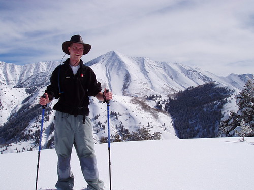
The final summit push involved climbing north up a wide wash to the saddle between the east and west summits of the mountain. The the weather had turned beautiful, with a brilliant blue sky, and the snow from the days before laid out before us like a white carpet. The only marks, were the trail that had been broken earlier that day. About two-thirds of the way up the wash, we met the party ahead of us, which included a 73-year-old man who had done the same hike every month for the last 12 years. I was starting to get a bit winded, but that encounter galvanized me for the rest of the climb.
We decided to go to the west summit, because it was slightly higher, and that's where the trail went. When we got there, the views were incredible! Mount Timpanogos, Cascade Mountain, Provo Peak, and Mount Nebo were all visible from the summit. Each looked especially spectacular with the recent snows. We spent about 45 minutes on the summit enjoying the view and taking pictures.
After the summit, coming back down was easy. The day was pretty warm for February, and once we got to the west face of the mountain, the snow we had seen on the trails earlier was replaced by mud. We made it back down to the car in just over an hour after we left the summit. Congratulations were made, and a good time was had by all. This hike was definitely a great introduction to winter hiking.