Diamond Head Trip Report
Peak Trail, 05/25/11
I had the pleasure of spending a week in Hawaii for the annual ICSE conference. From our hotel on Waikiki, the volcanic cone of Diamond Head was clearly visible. A little bit of research indicated it was a popular hike to the summit, so the day before the conference began, I joined Alan and Tim (of Table Mountain fame) to do the hike.
The conventional wisdom is to hike Diamond Head in the morning, while the air is cool, the sun is down, and the crowds are lighter. Instead, our little group (including Tim's wife and daughter), headed to see the sights at Pearl Harbor early in the morning, to beat the crowds there. After seeing the USS Arizona memorial, as well as the USS Missouri and a few other museums, we headed over the Diamond head for our hike. We saw a few people walking from the main road to the parking lot, and were glad we drove, even after paying the $5 parking fee.
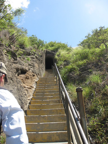
Even though it was mid-afternoon by the time we got going, it didn't really feel that warm, compared to the heat I was used to in Texas. We headed south, on what was first pavement, and then a well-worn and wide trail. The trail was reputed to be steep, but I only noticed a few pitches where I was a bit short of breath. After a couple of switchbacks, we had reached the first set of steps and started climbing. The steps aren't particularly steep either, but there do seem to be plenty of them.
The first steps of stairs lead to a tunnel, which then empties out at the base of a spiral staircase in a World War II-era bunker. During the War, Diamond Head was used as an observation post for gun emplacements located closer to Pearl Harbor. The remnants of the post remain, and the route to the top, follows the spiral staircase up for a couple of levels. Upon exiting the staircase, we were greeted by a fellow offering to sell us a "certificate of completion" of our hike. We politely declined.
Upon existing the bunker, we got our first look at the ocean, which had been hidden to this point by the crater walls. From that point, it was a short walk around the bunker to the top, and some pretty good views of the ocean, the mountains, Waikiki Beach, and the rest of the surrounding area. (It was also about when my camera batteries died, unfortunately.) All told, the walk up to the top took about 30 minutes, and wasn't very difficult at all.
After enjoying the view, we made our way back down the hill, admiring the scenery. It didn't take too long to get down, but we did have a bit of trouble navigating the streets in our attempt to get back to Waikiki. When we finally did arrive, I decided to enjoy an evening by myself, after what was a very long, but enjoyable, day.

