Cascade Mountain Trip Report
Dry Fork, 09/05/05
Labor Day: a time for doing laborious things, like making another attempt at Cascade Mountain. The weather was excellent, and I had managed to convince Bruce into coming on yet another wild adventure. Actually, it didn't take much convincing; Bruce had already been up on one of my Cascade attempts, and was eager for another shot at this imposing mountain.
We again opted for the Dry Fork route. Judging from my experience in Bunnells Fork in May, we figured that the trail would be pretty impassible due to the avalanche debris and the lack of maintenance. We also chose to drive to the Rock Canyon campground, instead of hike from the mouth of Rock Canyon, which shortened the trip by 3 miles each way and 2000 vertical feet. The road from the Hope Campground to the Rock Canyon Campground is generally well graded, and we only found a couple of spots that were tricky for my passenger car. We hit the trail at 7:30am.

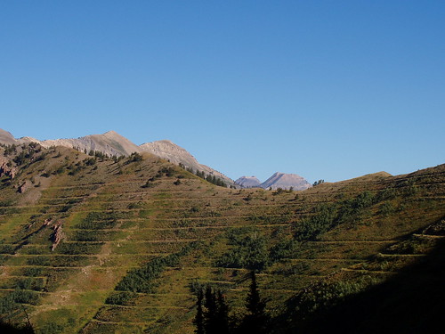
The first couple of hours up the trail were much like our attempt in June, only without the snow. We made good time going up the canyon, and although it was cool to start, we quickly shed our jackets as we got moving. The trail was well maintained, and we could tell that it had been worked on this year. Instead of cutting up the terraces to Cascade Saddle like we did in June, Bruce and I made the wise decision to stay on the trail, as it swings south below Freedom Peak. This made the going a whole lot easier than it was going straight up the side of the mountain.
From the saddle, we followed what appeared to be a faint trail going west. We knew that the route was basically a ridge traverse that followed the ridge west and then north to the summit, but it would prove to be more than we bargained for. The trail petered out, so we followed a terrace, which also gave out. From there, we tried to cross to the north side of the ridge, but that side turned out to have an area of rather impassable cliffs, so we went back to the south side. Eventually we found a "social path" that we spent more time finding than following.
We were making better time than June, but it was still slow going, especially as the route began to become a bit more technical. We would often have to backtrack as we discovered that a route was too difficult or unsafe. There were a couple of other people on the mountain, and we were able to follow them occasionally, but generally we picked our way through the brush and scree. By the time noon rolled around, we had turned the corner of the ridge and were headed north toward the summit, but we were still quite a distance from our objective.
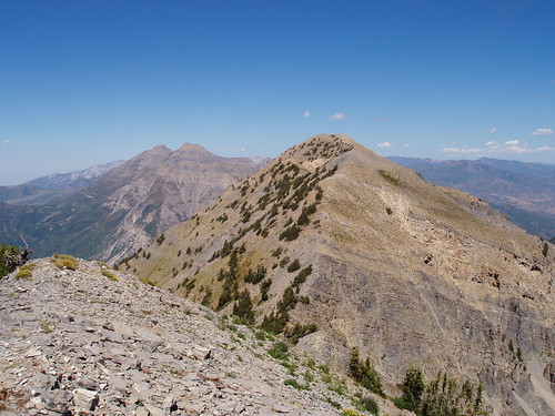
The Cascade ridge has four distinct points; the southern most one is often called the south summit and is only a few feet shy of the true summit, which is the second point from the north, and quite a walk from the south summit. Between them, the ridge dips 400 feet or so. We had lunch right below the south summit and then followed the trail to it. The views were great, but because we were headed to the true summit to the north, we didn't stop, but kept going. The south summit is a great destination for those who don't have the time or energy to continue on.

Even though it looks close, the true summit is still quite a bit of work from the south summit. We descended along the ridge, and then followed the trail as it worked it's way north. Sometimes the route would be on the ridge, at other times it would be below it to the west. I found that we could measure our progress by looking at the streets on the valley floor to our left. It was taking a while, but we were making progress toward our goal. Finally, a little after 2pm, we gained the summit.
Aside from a bit of wind, the weather had been great to this point, so we decided to spend a bit of time on the summit. The other person to summit that day, Dave, was there when we arrived and we chatted with him for a bit. We ate the rest of our lunch, and then hunted around for a geocache that had been placed near the summit some time earlier. After resting and taking a few more pictures, we turned around and started the long hike back home.
The traverse south was about the same as our route to the summit. We managed to miss the use trail and spent most of the afternoon working our way over scree and loose vegetation below the ridge, which ended up taking much longer than we planned. We also briefly toyed with the idea of descending down the same chute that we did back in June, but instead decided to continue to the saddle and then follow the trail that we already knew and which was not as steep.
By the time we were back to the saddle, the sun was beginning to dip low in the sky. We realized that we still had a bit of hiking in front of us, and although it was downhill on a well established trail, it couldn't go fast enough. As the evening settled, more wildlife came out and we saw three deer just a few yards down the trail from us. The air was cool as we settled into a nice mountain evening, and we stopped often to take pictures of the mountain beauty around us. We reached the car around 8pm, as the last vestiges of light were fleeing from the sky.
The hike was a lot longer than we planned, but well worth it. We got to spend some great time on a rugged mountain that few know the name of, or even visit. On a personal note, I was glad to finally tackle a mountain that I had spent a bit of time trying to do. Our route may not have been the quickest, but it was great to get out on one of the last decent days of the season.