Boundary Peak Trip Report
Queens Mine, 08/24/13
The Approach
Since moving from the West, my chances for hiking in the high mountains have been more limited than I like. So when Ian suggested we make a run at Boundary Peak when I was out in California for business, I took him up on the offer. It took a few years for the timing to work out, but in late-August of 2013, the snow was off the peak, and I had a free day after a business trip, creating the recipe for another highpointing adventure. Bruce (of Lone Peak and Mount Whitney fame, among others) was free as well, so he rounded out our crew for a climb of Nevada’s highest point.
Boundary Peak earns the highpoint distinction--and its name--by being just over the Nevada-California boundary. A subject of historical dispute, the boundary now settles in the saddle between Boundary Peak and the slightly higher Montgomery Peak to the south. If the boundary were a few yards to the south, and Montgomery Peak would be the high point; a few yards to the north, and Wheeler Peak on the other side of Nevada would be its highest point. As it is, Boundary Peak was the destination as Bruce, Ian and I set out early Friday morning.
The White Mountains in which Boundary Peak sits are about six hours’ drive from the San Francisco Bay Area. Our plan was to spend Friday driving to a campsite at the trailhead, do the hike on Saturday, and drive back that evening. This left a bit of extra time on Friday, which we planned to spend in Yosemite National Park, a sort of warm-up for our hike. Fires had been raging to the northwest of Yosemite, closing one of the main roads in, meaning our drive was going to be a bit longer than we planned. No bother, as this allowed us to come in the south entrance and see more of the park before continuing to our camp for the night.
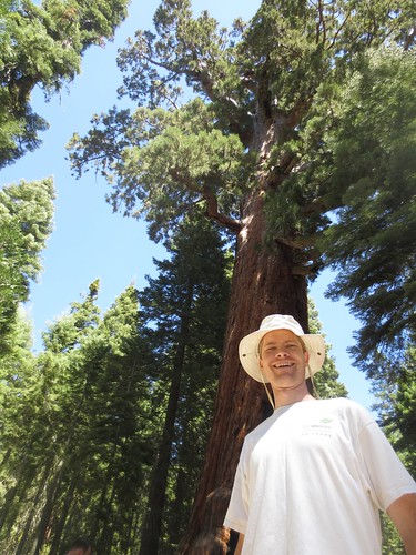
I won’t say much about Yosemite, other than that I’ll be back. We drove just about every road in the park, hiked through the giant sequoias in Mariposa Grove, and visited the overlook at Glacier Point. The smoke from the fires stayed mostly to the north, and we had spectacular views into the park. As we drove over the Tioga Road to the east, I thought about all the other places to hike and camp in the park. I’ll be back again some day.
It was getting to be dusk as we drove over Tioga Pass and out of the park, and the smoke from the fires was starting to settle into some of the valleys. For dinner, we decided to stop at the Tioga Pass Resort, a seasonal place just outside the park at around 9,500 feet. We were surprised at how cool it was, and after a brief wait had a very filling--and reasonably priced--meal. Continuing toward Boundary Peak, we caught brief glimpses of the surrounding mountains as the night settled for certain.
We planned to reach the trailhead around dark, but as it was we spent the last couple of hours of the approach driving through darkness. Save for one very close call with a deer, the drive from Lee Vining to Benton, California was uneventful. At Benton, the route joins the venerable US-6 as it heads into the Great Basin of Nevada. We only made it three miles into Nevada, however, before finding the turnoff onto the dusty dirt road that would take us to the trailhead. Only 3 miles across the state line, it wasn’t hard to miss, even though we were coming in the dark.
From that point, our trip got a bit more exciting. We had read from other trip reports that the road was passable with a sedan, but sadly Ian’s Hyundai didn’t prove up to the task, as valiantly as it fought. In places where the road was steep, large ruts caused by erosion were several inches wide and deep, making the travel treacherous. From the backseat, if felt like a bit of a rollercoaster ride that wouldn’t stop, as the headlights cast strange shadows on the road’s surface. In the end, rather than risk stranding our car and ourselves high on the mountain, we stopped at around 8,500 feet, and gently parked the car off the road.
We hadn’t made it to the camp near the trailhead, and finding a level sleeping area was not easy. The terrain was slanted, with the occasional rock or sagebrush. In the end, we settled on a piece of dirt that looked like it could fit us without our slipping too far down into the gully below. To improve matters, Ian moved a rock from his head to Bruce’s feet, allowing Bruce to anchor himself to the hill. As for me, I found that if I lay very still, I wouldn’t slide down the hill, but staying that way was hard. In such conditions, we settled down to sleep around 10pm.

At 10:30, the full moon rose above the surrounding terrain, like a flashlight in my face. While lovely, it made sleeping difficult, and I spent the rest of the night tossing and turning to get rested. Laying there trying to sleep gave me new appreciation for the silence of the desert. I realized just how far from civilization we had come, and hoped that the car could get us back.
Finally, around 5:30 in the morning a couple of ATVs rolled up the road past us. We were far enough off that they probably didn’t see us in the early-morning light, but the sound was enough to drive all thoughts of sleep from our heads. By 6am, we were up and packing up camp, complete with a harmless visit from one of the local scorpions. After a brief natural break and breakfast, we were on the trail by 6:40am.
The Climb
There are two major routes up Boundary Peak, the more established Trail Canyon route and the less-well-known Queen Mine route. Both routes meet at a saddle below the summit, and to get there the Trail Canyon route goes straight up the face of a cirque, while the Queen Mine route traverses the main ridge. As our chief strategist, Bruce selected the Queen Mine route, for the easier approach to the trailhead and less-steep climb. It made the climb a bit easier, albeit slightly longer.
While there is some scrub and brush down below, the entire route is exposed. Not knowing the type of weather to expect, I started the day in a jacket, and was carrying several liters of water to drink. Foolishly, I’d forgotten how easy it was to sunburn in the high altitude and while we’d picked up sunscreen in Yosemite the day before, I didn’t put any on. I did, however, remember my ordeal on Spanish Fork Peak several years earlier, and even though I didn’t take my leggings off at all during the climb, I was ready to use the sunscreen if I did.
Since we hadn’t made it to the trailhead, our first goal was to get there. We followed the road as it went up the hill and past the several abandoned mines which give the route its name. Some sections were steep, and I settled into my own pace, breathing steadily while adjusting to the altitude. Even though we were coming from sea level, I was surprised by how much the altitude as low as 9,000 feet affected me. Ian tended to set a faster pace, while Bruce brought up the rear.
As the sun slowly rose above the mountains, we could see the valleys to our north filled with the hazy smoke from the day before. When we reached the saddle with the real trailhead and entered Boundary Peak Wilderness Area, we picked up a slight breeze from the south. It was quite pleasant: not enough to be cold, but enough to keep the bugs down (such as there were). Throughout the day the views steadily improved as the smoke moved farther to the north. At the saddle, we signed the trailhead register and left the dirt road to begin the ridge traverse on a well-maintained single-track trail.
It was here that we got our first glimpse of Boundary Peak. It’s plainly visible from US-6, but since we had driven up in the dark, we hadn’t yet seen the actual mountain. From the saddle, the final ridges looked doable, but imposing. We knew we still had significant elevation to gain, but after a short but steep section on the ridge, the trail continued mostly level as it ran just below the actual ridge. We were around 10,500 feet, and while the occasional tree attempted to eke out a living this high on the mountain, the terrain was mostly bare.

We continued along the ridge trail for almost a mile, before dropping down slightly into the saddle where the Trail Canyon and Queen Mine routes combine. It was about 9:10 am, and we had made some good progress. The saddle was wide and open, with a small windbreak and gentle slopes down into the canyons below. Here we stopped for a rest and some food, and Bruce told us he was feeling a bit ill due to the altitude and wasn’t going to continue up the mountain. We didn’t protest too much, since we could tell he was struggling. Instead, we finished our break, and started into the hardest part of the climb. I also added some tape to a couple of hot spots on my feet, hoping they wouldn’t develop into blisters later on.
From the saddle at 10,800 feet to the summit at 13,140, the route gains over 2,300 feet in the distance of about a mile, for an average grade of over 40%. In any circumstance, this is a bit of a workout, but coming from sea level and climbing this grade in two-thirds of the air, made it a bit difficult, to say the least. I know from other experiences that I slow down in higher elevations, so I expected this last bit to take a while, and it did.
Fortunately, the trail was surprisingly well-marked, with frequent cairns and observable trail surface. We occasionally had to route find, but not often for very long. We had come prepared with gaiters, but didn’t ever feel the need to put them on, as the surface was either large rocks, or level gravel. Only once or twice did I find myself slipping because of steep gravel.
Shortly after leaving the large saddle, Boundary Peak itself disappears from view, and the immediate goal becomes a false summit at about 12,100 feet. The trail climbs the rock field on the right, or west, side of the ridge, and eventually veers to a low point to the west of the false summit. It felt like it took forever to get there, as every few steps Ian and I stopped to catch our breaths before moving on.
The elevation was starting to take its toll, as I had a headache which grew with every step and was starting to feel nauseated. There were also times that I’d open my eyes and find myself a bit dizzy. In retrospect, these are all symptoms of acute mountain sickness, and I probably should have been more cognizant of them. As it was, we reached the point near the false summit and ate and rested before attacking the last pitch on the ridge.
Before setting out that morning, we had determined that our turnaround time would be 12:30 pm. If we hadn’t made the summit by then, we’d turn around to make sure we had the energy to get back down. I hadn’t really been paying much attention to the time, but as Ian and I made our way up the white granite slopes toward the summit of Boundary Peak, I wondered how close we were. We still required several breaks to climb the last 1,000 feet, but with the continued great weather and the summit looming ever closer, we continued with a renewed sense of purpose.
Finally, we ran out of ridge. We crested the summit of Boundary Peak, the highest point in Nevada, at 12:08 pm. After the ordeal to get to the top, I was really just glad to sit and rest for a while, and even more thankful that my next steps would take me down into thicker air. By this point, though, the gentle south breeze had blown the smoke from the fires toward the north, and the views all around were absolutely spectacular. With a deep blue sky overhead, we could clearly see the Sierra Nevada to the west, and miles of desert in every other direction. It reminded me why I go on these crazy adventures.

We signed the summit register, rested, ate a bit more, took a few pictures and then reality set in. My nausea and headache were still strong, and the best way to relieve them would be to descend. Descending meant walking down the trail we’d just come up, and while that meant more air, it also meant more work. It’s one of the few times in my life when I’ve looked around and realized there is only one legitimate option for solving a problem, however unpalatable it may be. I couldn’t wait for it to go away: I had to press forward.

So we made our descent. It took some time, as I found that choosing good foot location on the uneven terrain took some effort. At one point just above the false summit, we met another party of hikers who had come up from the Trail Canyon route. They were planning on climbing Boundary that day and then doing Mount Whitney as a two-day backpacking trip the next couple of days. Knowing what they were in for, I wished them well.
As we rounded the false summit, we could see Bruce far below. Looking down, I realized just how far we had climbed, and like any such feat, found myself wondering how in the world we had done it. When we finally got down to the saddle and Bruce, he was in good spirits and well-rested, having taken a two-hour nap while waiting for us. We ate a bit more while Ian and I told Bruce of our climb. He could probably tell we were a bit beat, and mentioned we looked like he had after coming down from Mount Rainier a few years earlier.
We retraced our footsteps across the ridge, and I was moving on autopilot. I had a single focus: get back to the car and out of my shoes, which had by this point created several hot spots on my feet. My sunburn was also starting to set in, and while I had applied a bit of sunscreen while coming off the mountain, I had underestimated the effects of the high altitude on those of us that are fair skinned. I could tell Ian was suffering as well, as he was also setting a fast pace back toward the trailhead.
At the trailhead, we rested briefly, but the end of our ordeal was in sight. We hiked down the double track dirt road, past the abandoned mines and their tailings, and got back to Ian’s car around 4:20pm, a little under ten hours after we started that morning. We had hiked the highest point in Nevada, spent the majority of the time above tree level, enjoyed good company and seen only a handful of other people the entire time. The weather had cooperated, and although a long drive still lay ahead of us, I was glad to know I’d had the mental toughness to survive. I was also feeling much better in the thicker air of our parking area. (Strangely, we never met the other people who signed the trailhead register, nor saw the ATV group that had woken us up that morning.)
The Aftermath
Even with our return to the car, the trip wasn’t yet over: we needed to get down out of the mountain, find a place to eat dinner, and then make the six hour drive back to the Bay Area. It was going to be a long night, but fortunately Bruce had gotten a good nap while waiting for Ian and I to summit the mountain, so he was refreshed and ready to drive most of the way home. I knew that the timing would be important, since I was staying at Ian’s house that night before going to Church and catching an early-afternoon flight home the next day.
The drive down the hill seemed to take forever. It was easier doing it in the daylight, but Ian still had to navigate the large ruts we’d encountered the night before, and without the excitement of heading to the trailhead, the road seemed much longer. We finally managed to get back to the highway with all our tires intact, and began the trip back to the Bay Area. Looking back, I was surprised how dominant Boundary Peak was on the skyline for the first fifty miles of the trip back.
Our route back to the Bay Area was a bit circuitous due to the growing fire near Yosemite. Instead of going through Yosemite, we needed to take a more northern route through the Sierras: Highway 108. This meant finding food relatively soon, and that meant a stop in the town of Lee Vining on the shores of Mono Lake. The local pizza shop being closed for the summer, we chose a well-reviewed barbeque place on the south end of town, which turned out to be a good choice. After dinner, we switched drivers and settled into the car for the long night ahead.
While usually an afterthought on most hikes, the drive back home turned out to have its own set of challenges. We managed to hit a drivers license and sobriety checkpoint in Bridgeport, which Bruce passed deftly. The officer asked about our plans, and mentioned our route was still open, but likely to close soon due to the impending fire danger. A few more miles up the road, we missed our turn onto highway 108 and had to backtrack to avoid going another fifty miles out of our way.
We also discovered that Highway 108 was twistier than a bucket of worms, which made for extremely slow going. The road was also quite lonely and the dusk and smoke made for a very dark ride. As some point in the middle of the Sierras, it occurred to me that our only connection with civilization was a ribbon of asphalt: we were still very much in the backcountry.
The smoke reminded us we were still close to the large fires, and at some point point we could see a sullen moon rising about the flames in the distance. I dozed for a bit, and after stopping for gas in Oakdale, it was smooth sailing into the Bay Area. We dropped Bruce off at his place around 1am, and Ian and I got to his house and finished unpacking. I hit the sack around 2am for a brief sleep before Church the next morning.
As I flew home Sunday afternoon, I made sure to check the plane’s route and sit on the side with the best view. From 30,000 feet up, we flew back over the route we’d driven only a few hours earlier. I could see the forest fire, Mono Lake and off in the distance, Boundary Peak. It was a bit surreal to realize that just 25 hours earlier, I had been standing on the top of that mountain, and that I was now flying through the air toward a reunion with my family.

Hiking, particularly hard hikes like this one, are often as much of a mental exercise as a physical one, and during the course of an event I often wonder to myself why I even bother. While I don’t have any good answers to that question, there’s a certain pride in the accomplishment, and a definite satisfaction in the journey itself. I was grateful for the good companionship of Ian and Bruce, and while I think that next time I’ll do more to prepare for drastic altitude change, I’m looking forward to my next adventure.